Inside Truly3D — From Mobile Mapping Capture to Usable Insight

Inside Truly3D — From Mobile Mapping Capture to Usable Insight
How Telecom Operators Use LiDAR for Pole and Conductor Inspection
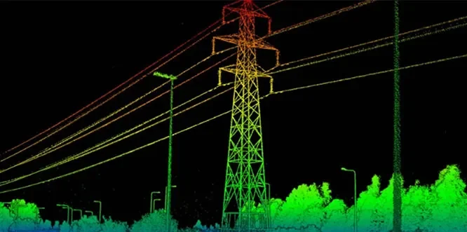
How Telecom Operators Use LiDAR for Pole and Conductor Inspection
Mobile Mapping vs. Handheld LiDAR — Which One Fits Your Survey?

In today’s fast-paced infrastructure and geospatial industry, accuracy and efficiency are more important than ever. Light Detection and Ranging (LiDAR) technology has emerged as a revolutionary solution for capturing highly accurate spatial data, enabling organizations to make informed decisions with confidence.